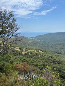
There is a specific magic to Cap Corse that you only truly understand when you leave the tarmac behind. Most travelers see this rugged peninsula through a car window, tracing the sweeping turns of the coastal highway. But if you want to feel the real pulse of this island, you have to slow down and follow the old stone paths.
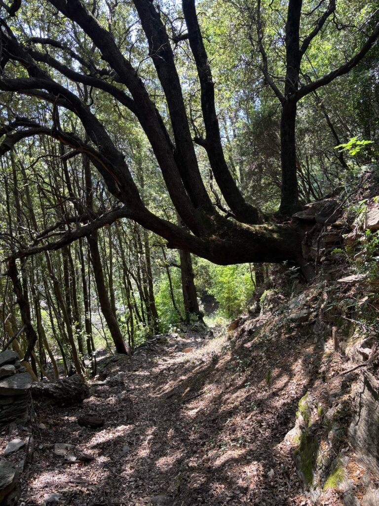
One of my favorite routes on the east coast is the journey from the sea up into the Cagnano valley. This trail does not just offer a change of scenery; it is a walk through time. By starting your trek right from the sand at Misincu Beach, you watch the landscape transform with every step. You leave the salt air behind, stepping into a shaded canopy of ancient holm oaks that has slowly swallowed history.
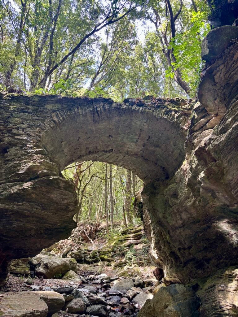
Along this path, you will cross an elegant, single-arched Genoese bridge built to withstand centuries of winter floods. Higher up, the forest reveals the haunting stone ruins of the abandoned village of Mitile and its forgotten watermills. If you are looking for a rewarding, moderate hike that captures the raw, self-sufficient soul of old Corsica, pack your boots. This is the complete guide to the Moulins de Mitile trail.
The History of Cagnano: Genoese Bridges and the Abandoned Village of Mitile
I have always found that the best trails tell a story of human movement. Long before this valley became a quiet escape for hikers, it was a bustling economic vein. Down at the coast, Porticciolo was not just a sleepy marine village. In the 18th and 19th centuries, it was a major maritime shipyard. Crafting large wooden cargo ships, locals used the port to ship the valley’s wealth across the Mediterranean.As you head inland, you follow the identical stone paths these early traders walked. The standout piece of engineering here is the old Genoese bridge. Its single, high stone arch was built to withstand the fierce winter torrents. This bridge ensured that farmers could always bring their harvests down from the high terraces.
Further up, the forest completely reclaims the abandoned settlement of Mitile. Walking through these stone ruins, left behind in the mid-1900s, humbles you. Nearby, you will find the skeletal remains of the old watermills. I like to picture them in their prime. The heavy lower stones crushed olives into oil, while the upper wooden gears ground chestnuts into flour. It is a hauntingly beautiful reminder of self-sufficient mountain life.
Secrets of the Spelonche: The Ancient Cave Dwellings of Cap Corse
If you keep your eyes peeled along the rocky slopes, you will notice deep fissures and overhangs. Locals call these natural rock shelters “spelonche”. To an experienced eye, they are much more than mere geological formations. They represent the oldest architecture on the island.
For thousands of years, these stone pockets provided vital shelter. Early shepherds used them to protect their flocks from sudden, biting mountain storms. Centuries later, coastal families fled into these same dark recesses to hide from marauding pirates. Today, these moss-covered caverns sit quietly along the path. They add a deep sense of antiquity to the walk. Passing them makes you realize just how long humans have sought refuge in this rugged landscape.
Moulins de Mitile Hike Guide: Trailhead, Distance, and Best Time to Visit
To get here, take the coastal D80 road north from Bastia. Turn inland at Porticciolo onto the twisting D132. Hikers usually park near the village hall in Ortale, where you will spot the yellow trail markers. If you want a slightly shorter walk, you can drive just past the hamlet to a sharp bend where the path enters the woods.
The trail uses the old mule tracks. It is a gentle, satisfying out-and-back walk that takes about ninety minutes at a relaxed pace. The climb is minor, making it easy on the knees. However, the old stones near the water can be incredibly slick. I highly recommend wearing a pair of broken-in hiking shoes with good grip as well as your favorite pair of hiking poles. I take mine on all my Corsican hikes and I rarely keep them folded.
Last week, I started the hike from Misincu Beach, a refreshing alternative that offers a different perspective and beautiful viewpoints. This is in my opinion the sole option that truly delivers the historic feeling of leaving the maritime world behind
The distances
The trail layout offers different tiers of immersion—from a quick forest stroll to your complete sea-to-mountain experience.Depending on where you decide to lace up your boots, here are the approximate distances and walking times
- Misincu Beach: 🚶🏽♀️🚶🏽~7.5km ⏱️~2.5
- to 3 hours – The full full coastal transition. Gradual, steady incline following the stream bed from sea level
- Ortale Village Hall (official Traihead): 🚶🏽♀️🚶🏽2.0km ⏱️ 1 hour 15m – The classic cultural route. Moves through the local hamlet before entering the oak forest.
- D132 Hairpin Turn (The Shortcut):🚶🏽♀️🚶🏽~0.6km ⏱️20 to 25 mins – A direct, brief plunge into the woods straight to the Genovese bridge and closest mill ruins.
The Coastal Approach: Hiking from Misincu Beach to the High Valley
How to Get There and Set Off
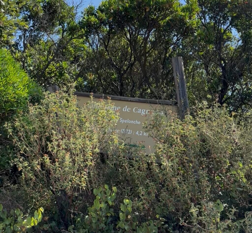
Instead of driving straight up into the hills, you leave your vehicle near the northern edge of Misincu Beach . The trailhead begins right on the opposite side of the road, in the middle of the D80 road curve, few meters away from the Beach Snack bar “A Piaghja”. Hidden under years of vine growth, the sign is a bit ttricky to spot but here is where you adventure begins. On a map, it is called ” Valle Di Figa Albula”. The path hooks westward, gently pulling you away from the sound of the surf and into the mouth of the Cagnano valley.
What to See Along the Way
The Transition of the Terraces: As you leave the sand behind, the first stretch of the path introduces you to the ancient agricultural layout of the coast. You will walk past dry-stone walls that once protected old seaside gardens and coastal vineyards, now partially tucked into the brush.
The Edge of the Domaine Terra di Catoni: The lower trail skirts the edges of historic estate lands and traditional olive groves. It gives you a firsthand look at how the valley transitions from coastal soil to fertile hillside farming terrain.
The Maritime Riverbed: Because you are starting at sea level, you follow the stream from its very end. This section allows you to see the changing flow of the water—from calm coastal pools near the beach to the quicker, rockier rapids you will encounter higher up by the Genoese bridge.
The Scent Shift: Pay attention to the air as you walk. Over the first twenty minutes, the salty sea breeze slowly gives way to the heavy, warm, resinous scent of the deep maquis as the canopy closes over your head, leading you seamlessly into the historic mule tracks.
My favorite time to walk this valley is late spring, right around May. The rivers are full of rushing snowmelt, and the old water channels come alive. Autumn offers a peaceful alternative with its crisp air and cooler temperatures. Summer is manageable, but the heat can be oppressive. If you go in July, start at dawn and pack twice the water you think you need. There is a fountain in the village of Carbonacce , which water is exquisite; there is another one mid distance between that village and the old convent of Oveglia but you must be sure to know how to locate it.
Cap Corse Nature Guide: Plants and Wildlife of the Cagnano Valley
The real joy of this hike is the sheer density of the canopy. You walk under a thick roof of ancient holm oaks and wild olive trees. These trees have slowly swallowed the old stone farming terraces. The air here is thick with the unforgettable, resinous scent of the Corsican maquis.
You will find yourself brushing past tall tree heath and sticky rockrose bushes. Down by the damp river banks, the flora changes completely. Here, wild mint, green ferns, and thick carpets of moss thrive in the shade.
If you sit quietly for a moment, the forest speaks to you. Look up to spot the small Corsican nuthatch moving through the branches. High above the valley ridges, red kites regularly circle on the wind currents. On the ground, you will likely see where wild boars have rooted through the soil. Near the stream pools, look closely for shy salamanders resting on the damp stones.